Two watersheds, one tap
Cedar and Tolt, on purpose
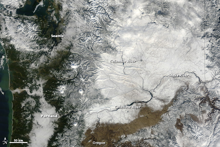
Cascade snowpack feeds two entirely independent rivers that supply Seattle’s drinking water: the Cedar River and the South Fork Tolt River. They are not two chapters of one connected river. The Cedar runs to Renton, into Lake Washington, and out through the Ballard Locks to Puget Sound at Seattle. The Tolt joins the Snoqualmie, then the Snohomish, and reaches Puget Sound about 20–25 miles north at Possession Sound, near Everett. They never physically meet.
The honest “one system” here is infrastructure, not hydrology. Seattle built its supply on two separated watersheds so a drought or a pipeline failure on one usually leaves the other standing. In 1987 a Tolt pipeline break was covered by rerouting water through the Cedar pipeline. Puget Sound is still the shared ending, reached by two unconnected routes.
Today's Pulse
It's September. The Cascade snowpack is only a trace (up to 0.1 in of water in the snow). Rex River feeds the Cedar; Skookum Creek feeds the Tolt. The Cedar at Landsburg is at 86% of its historical average for this date, and the South Fork Tolt is at 59 cfs near Carnation. Those are two rivers, not one reading. Chester Morse Lake sits at 1,550.04 ft. The South Fork Tolt Reservoir is at 1,732.56 ft. Those pools do not share a river. Observed Puget Sound water level at Seattle is 7.58 ft above MLLW. That gauge sits near the Cedar outlet at the Ballard Locks, not where the Tolt reaches Possession Sound. Seattle air quality is rated Good: satisfactory, with little or no risk from air pollution. That is not a water reading. Seattle built this as two independent watersheds on purpose. A drought or a pipeline break on one usually leaves the other one standing.
Worth noting today
- Today's South Fork Tolt flow is lower than anything recorded on Sep 9 in the site's 10-year archive.

Snowpack
Two SNOTEL pillows sit inside these municipal watersheds. Rex River is in the Cedar River Municipal Watershed and drains to Chester Morse Lake. Skookum Creek is a named tributary to the South Fork Tolt Reservoir. What they hold in winter is what those two reservoirs are still running on in late summer.
Live pillows
-
3,810 ft
0 in snow snow-free
-
3,320 ft
0 in snow
U.S. Drought Monitor, updated weekly: D1 Moderate Drought for the worst of Seattle, the Cedar, and the Tolt (10 days ago). Seattle D0 Abnormally Dry; Cedar Landsburg D0 Abnormally Dry; South Fork Tolt D1 Moderate Drought. droughtmonitor.unl.edu.
Active alerts
No active NWS warnings or advisories for this basin right now. That is a reading, not a missing feed.
Alerts here are a convenience copy of NWS polygons, not a substitute for NWS Seattle or county emergency services.
Active fire perimeters
No active NIFC perimeters in this basin right now. That is a reading, not a missing feed.
These outlines are a convenience copy of current interagency perimeters, not a fire assignment or evacuation map. See NIFC WFIGS and your county emergency services.
Reservoirs
Chester Morse Lake stores the Cedar. The South Fork Tolt Reservoir stores the Tolt. Live elevations come from USGS cooperative gauges, not from Seattle Public Utilities’ narrative updates.
Chester Morse is at 1,550.04 ft. The South Fork Tolt Reservoir is at 1,732.56 ft. Those are two pools. They do not share a river.
Live storage
-
Seattle Public Utilities · Cedar reservoir
1,550.04 ft elevation
Cedar River Municipal Watershed storage. Seattle’s older, larger source. Independent of the Tolt.
-
Seattle Public Utilities · Tolt reservoir
1,732.56↑ ft elevation
South Fork Tolt Municipal Watershed storage. Seattle’s second source, built so a failure on the Cedar does not empty the tap.
Cedar River
USGS 12117500 at Landsburg is the diversion point for Seattle’s Cedar supply: discharge, gage height, and water temperature. After the city takes its share, the river still runs to Renton and into Lake Washington.
Landsburg is running 228 cfs , water 53.6.
Before 1916, Lake Washington drained south through the Black River into the Duwamish. The Cedar’s current route to Puget Sound through the Ballard Locks is a 20th-century engineered change, not the historic natural path.
Live gauges
Cubic feet per second (cfs) measures how much water passes a point every second. One cfs is about 7.5 gallons — roughly a large cooler’s worth — moving by each second.
-
Seattle diversion
228 cfs 1.00 ft stage 0.3↑ FNU 53.6↓ °F water
South Fork Tolt
USGS 12148000 is officially named South Fork Tolt River near Carnation. The gauge sits near the reservoir, not downtown Carnation. It is the other half of Seattle’s supply, on a different mountain and a different river.
The South Fork Tolt is at 59 cfs , water 54.0.
From here the Tolt joins the Snoqualmie, then the Snohomish, and reaches Possession Sound near Everett. That is not the Ballard Locks, and it is not the Cedar.
Live gauges
Cubic feet per second (cfs) measures how much water passes a point every second. One cfs is about 7.5 gallons — roughly a large cooler’s worth — moving by each second.
-
Near the Tolt reservoir, not downtown Carnation
59 cfs 1.89 ft stage 0.4 FNU 54.0↓ °F water
Puget Sound
NOAA station 9447130 in Seattle reports observed water level and tidal predictions. Those are kept separate here, the same way forecast and observed data stay separate on this family of sites.
Observed water level: 7.58 ft above MLLW.
Predicted tide: 6.87 ft above MLLW. That is a harmonic forecast, not the gauge.
This station sits near the Cedar system’s outlet at the Ballard Locks. It is a representative reading of Puget Sound generally, not literally where Tolt water enters Possession Sound 20-plus miles north.
Explore the map Lakes, reservoirs, snow, and both rivers as layers you can turn on.
Keep going
The story chapters stop here. These pages are the rest of the live site: the decade archive and who is already working on these waters.
Trends
Today's South Fork Tolt flow is lower than anything recorded on Sep 9 in the site's 10-year archive.
Support
Seattle Public Utilities, tribal governments, Ecology, and the Puget Sound Partnership are already on this water. Support lists who to read and where to comment.
Explore
The map is the same two watersheds, not one river chain. Chester Morse and the Tolt reservoir stay on separate lines.